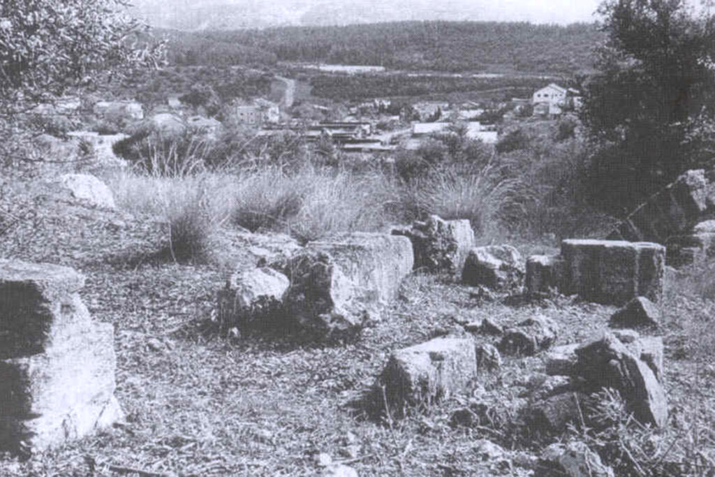
A Palestinian Arab village displaced since 1948, located west of the city of Jerusalem on the main paved Beit Jibrin-Bab al-Wad road. Zionist organizations attacked it in 1948 in Operation Danny carried out by the Harel Brigade, expelled its residents and then destroyed its homes.
the site
The village of Ishua is located to the west of the city of Jerusalem, 27 kilometers away. It is on the main paved Beit Jibreen-Bab al-Wad road. It rises about 275 meters above sea level. Its built-up area was about 18 dunums (a dunum is equivalent to a thousand square metres) in 1948 out of its total area. The area is 5500 dunums.
It is connected by paved roads to the villages of Aslin, Artuf, Beit Mahsir, Deir Ayoub, Kassala, Saraa, and Beit Sousin.
Its location is distinguished because of its proximity to the main road between Jerusalem, Jaffa, and Beit Jibreen, which belongs to the city of Hebron, and this explains the settlement there since ancient times.
A government school was opened in the village of Ishua in the academic year 1937-1938. It began with one teacher teaching three grades from the first to the third of primary school. That teacher was Amin Mahmoud Awad, who remained working in the village school until it was occupied in the 1948 war.
Over time, the school developed and the number of its classes increased to the seventh grade of primary school. Thus, Eshwa Government School had the highest grades among the schools of neighboring villages, and it began to receive students from those villages.
Population
The population of the village in 1922 was about 379 people, and in 1931 statistics it rose to 468 people, all Arabs, living in 126 houses. The number rose in 1945 to 620 people, and in 1948 there were 719 people living in 193 houses.
Label
There is a difference in the origin of the name of the village of Ishua. Some sources stated that it dates back to the Canaanite word “Eshtoul,” which means “to ask.” As for the villagers, it is likely that the name is attributed to the Prophet Joshua, peace be upon him. Researcher Abbas al-Nimr stated that the name was distorted over time to become Yeshua.
Village landmarks
The most important landmark in the village is the Maqam Shu`a, which is located in the square opposite the mosque from the western side. It was a place for visits, blessings, and supplications.
The village includes many ruins, such as Khirbet Hamada, which includes the rubble of collapsed buildings and caves, and Khirbet Sheikh Ibrahim, located on the southeastern side of the village, and Khirbet Deir Abu Qaboos, located to the north. These ruins include caves, dug tanks, and an olive press.
In addition, there are the lands and shrine of Sheikh Gharib, and the Ishu’a Well is considered one of the archaeological landmarks in the village. Its people believe that Khirbet Sheikh Gharib is a blessed land, and every person who went to war during the days of the Turks would plant an olive tree there.
Ishua included some shops, a mosque and a primary school, and it contained some ancient ruins.
To the north of the village is Ain Eshou, which the people relied on to supply them with drinking water, in addition to their reliance on the water of some nearby small springs, and on wells to collect rainwater.
Economy
The village people worked to plant olive trees on their land, and the proceeds were distributed to the poor and needy people of the village.
The area of Ishua’s lands is 5,522 dunams, all of which belong to Arabs. Its lands were invested in growing olives, grapes, and other fruits, as well as in grain cultivation, and its agriculture depended on rainwater.
The occupation of Eshua and the displacement of its population
It was stated in the book “History of the War of Independence” by Israeli author Uri Milstein that the 4th Battalion of the Harel Brigade destroyed the village on July 16, 1948 as part of Operation Dani.
This means that all of its residents who remained behind after the barrage of mortar bombs were eventually forced by the occupying forces to leave.
Settlements on the lands of the village of Ishua
In 1949, Israel established the colony of Eshtaol, on lands belonging to the villages of Ishua and Islin. Settlement there began in the form of a moshav (a Zionist settlement group that takes a cooperative form and has a military character) inhabited by a group of Yemeni Jews.
Ishou village after displacement
Only a few houses remain at the site of the village of Eshua, scattered among the settlement’s homes, some of which are used as residences and warehouses.
The village cemetery, located next to the settlement’s administrative building, was bulldozed, razed to the ground and planted with weeds.
At the southern end of the cemetery is a cave containing a wheat mill, and olive and carob trees grew on the site, along with other trees that were later planted by the settlement’s residents.
A football field was built at the western end of the village, on one side of which the walls of destroyed houses and their crumbling roofs are visible.
Most of the village’s displaced people lived in camps in the Ramallah area, such as Al-Amari Camp and Qalandia Camp, and were nicknamed Al-Shu’aniya.
Source : Palestinian press + Websites


