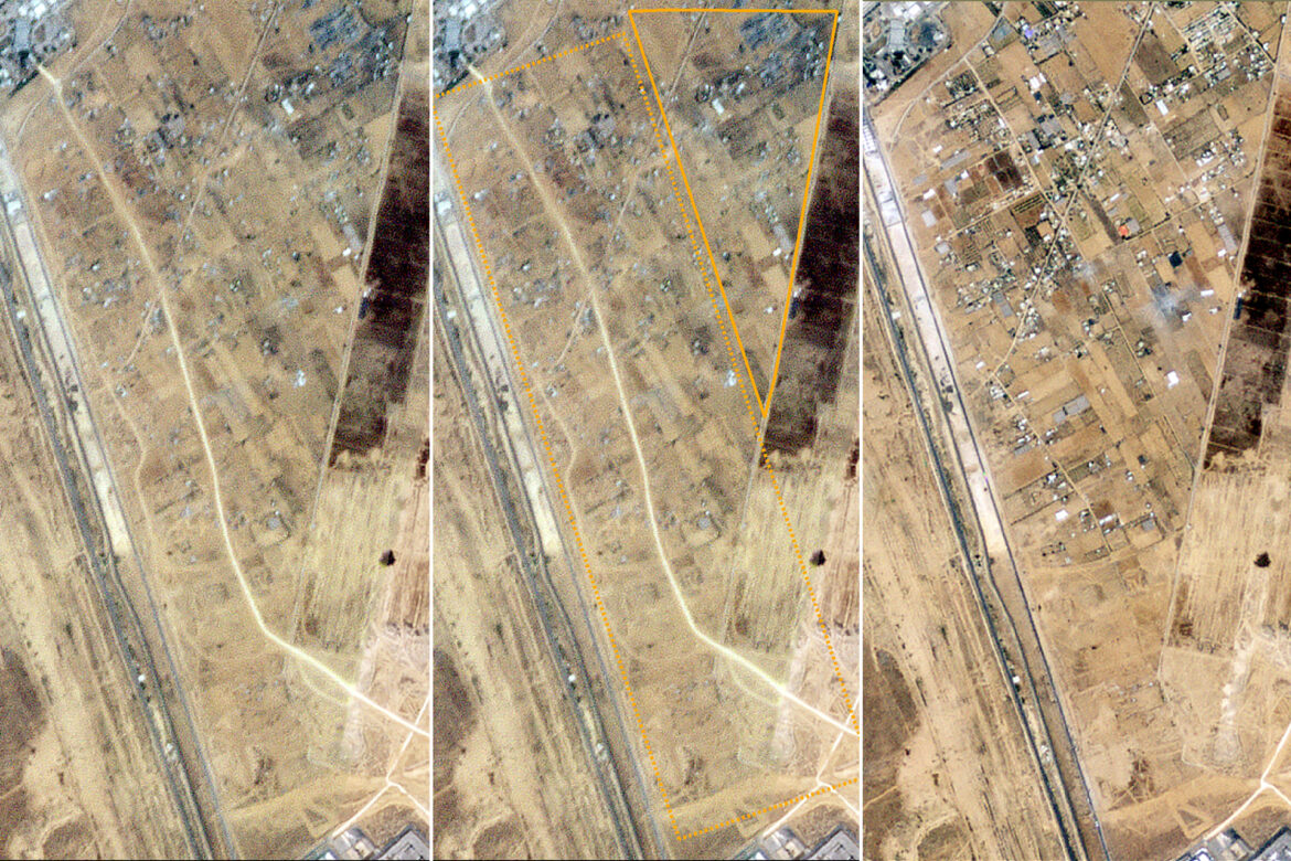
Satellite images showed the leveling of areas and the construction of logistical supply routes by the Israeli army along the Philadelphia axis, east of the Rafah crossing, south of the Gaza Strip.
Pictures published by the BBC Planet Labs website, taken between May 3 and May 11, showed the occupation forces paving two logistical supply routes. The first connects the Kerem Shalom military site to the Rafah land crossing, and is 300 meters away from the Philadelphia axis. It is 3.5 kilometers long, and its completion appears in photos taken on May 11.
The pictures also show the construction of a second road linking the Amitai military base to northern Rafah, and paving work on it has stopped since May 3, in addition to the occupation bulldozing and destroying lands and buildings at a distance of 600 meters from the Philadelphia axis.
The occupation forces continue their ground attack in the areas east of Rafah and control the crossing there, causing the displacement of about 450,000 people, according to the United Nations Relief and Works Agency for Palestine Refugees (UNRWA).
On the seventh of this month, the Israeli occupation army announced its control of the Rafah crossing, which connects Egypt to the Gaza Strip.
The occupation army said – in a statement – that “the forces of the 401st Brigade achieved operational control over the Rafah crossing from the Gaza side, and separated the crossing from the Salah al-Din axis.”
Thus, the occupation forces have penetrated the Salah al-Din “Philadelphia” axis – for the first time since their withdrawal from the Gaza Strip in mid-August 2005 – which is a 14-kilometre-long border strip that separates the Palestinian territories in the Gaza Strip and the Sinai Peninsula, and the peace agreement between Egypt stipulates Israel is to have a “buffer zone” along the border between the two parties.


