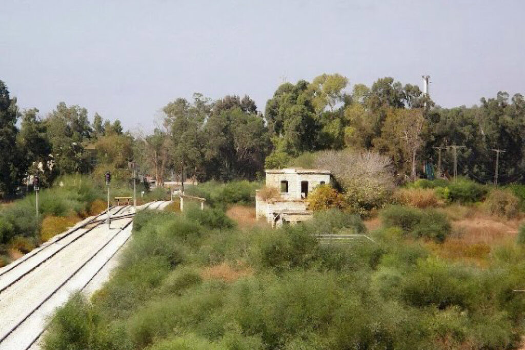
A displaced Palestinian village that was located to the southwest of the city of Jerusalem. It was occupied in the first phase of Operation “Hahar” (The Mountain), which was launched by Zionist military organizations to displace Palestinian villages in the 1948 war.
The village of Bureij fell into the hands of the Israeli occupation between October 19 and 24, 1948.
the site
The village was located southwest of Jerusalem, 28 kilometers away, and its average height above sea level was about 250 meters.
It was on a plateau between two valleys bordering it to the north and south, and an existing secondary road west of the village connected it to the main road connecting Jibreen (Hebron District) and the Jerusalem-Jaffa main road. There were also dirt roads connecting it to neighboring villages.
The village is bordered to the east by the Monastery of Beit al-Jamal, the village of Deir Aban, and the Monastery of Rafat, to the west by a mosque and Khirbet Amoria, to the north by Deir Rafat and Beit Far, and to the south by Zakaria and Ajjur.
Population
Its population was estimated at 382 people in 1922, and in 1931 it reached 621 people and the number of houses was 132 houses.
In the 1945 census, the population reached 721 people, including 10 Christians who were from the Manoli family. The population in 1948 was about 835 people.
History of the village
The word “Al-Brej” is a diminutive of the word “tower”, which is a high place and is derived from the Greek word “Pyrgos”.
The village’s houses were spread across the site without any special planning. However, modern buildings were erected parallel to the roads leading to the village from several directions, which made its plan take the shape of a star, and its houses were built of cement and stones.
Economy
Most of the village residents worked in agriculture and livestock, and the area of land cultivated with various types of grains reached 9,426 dunums (a dunum is equivalent to a thousand square metres), 88 dunums of olive trees, 31 dunums of citrus fruits, and 77 dunums of irrigated orchards, and the rest of the lands, an area of about 9,532 dunums, were allocated for grazing all types of livestock. Of sheep, cows and camels.
Forest trees spread among the pastures – including oak, swede, styrax, carob, and gondola trees – which were used to cut firewood for use in stoves or to make charcoal or clay, which was used in building village houses.
Village landmarks
The village lands include a group of archaeological ruins, such as Khirbet Amer, Bir al-Laymoun, and Khirbet al-Ayn al-Bayda, which contain inscriptions, cisterns, columns, wine presses, caves, and areas covered with mosaics.
These antiquities belonged to Byzantine, Greek, or Canaanite civilizations, and did not include any Hebrew monument. Among the shrines present in the village are the shrine of Abu Wahish and the shrine of Sheikh Ubaid. Bir Zablah and Al-Ain Al-Bayda were the sources of water in the village.
A primary school was built in the village for the first grade until the fourth grade. In Bureij there is an old mosque called the Al-Omari Mosque. It is said that it was built in the era of Caliph Omar bin Al-Khattab. It can accommodate a large number of worshipers and has stone columns and arches inside it. The mosque’s muezzin was Sheikh Jabr.
The village had 4 mukhtars: Hajj Youssef Nasrallah, Abdullah Al-Sharsh, Muhammad Al-Khadja, and Ahmed Hussein.
The village has a health clinic, but construction was not completed, so its residents used to go to Jamal and Rafat’s house for treatment, and the village cemetery was on the northern side.
Occupation and displacement of its population
Bureij was occupied in the first phase of Operation Hahar, and fell between 19 and 24 October 1948 as part of a move by Israeli forces to seize some villages in the southern part of the Jerusalem Corridor.
Israeli settlements on village lands
The result of the occupation was the displacement of the villagers, their displacement to areas inside and outside Palestine, the destruction of the village, and its ethnic cleansing of its people.
The occupation built the “Sdot Micha” settlement south of the village site in 1955, and worked to replace its original inhabitants with Moroccan Jews.
Today, the village site has become part of a large military base called “Kanaf Shteim” (the second wing). A large area has been fenced off, in which a watchtower has been built, and the public is prohibited from entering it.


