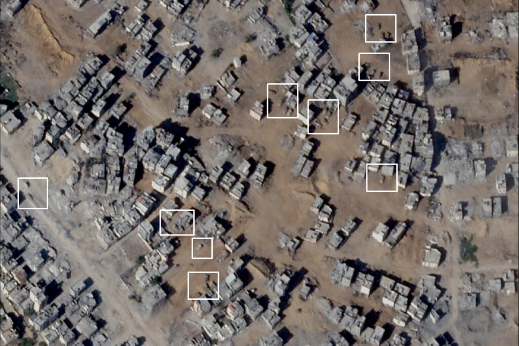
Satellite images dated October 11 showed areas where Israeli military vehicles were deployed in the northern Gaza Strip.
The pictures show large numbers of military vehicles entering the Gaza Strip from two offensive axes, the first from Beit Lahia in the north, and the second from east of Jabalia.
The military occupation forces are deployed on a continuous line surrounding the North Gaza Governorate and isolating it from the rest of the Strip.
For the tenth day in a row, the residents of the northern Gaza Strip are suffering from continuous genocide, as the Israeli occupation forces besiege the Palestinians and target anyone who moves to fetch water or operate wells in the area.
Thousands of civilians were unable to leave their homes while they suffered from a severe shortage of water and food due to the occupation preventing the entry of relief aid and drinking water trucks.

Dozens of bodies are still scattered in homes and streets, especially in Jabalia camp, and have not been recovered under these circumstances, and wounded people are still stuck inside their homes and unable to reach the hospital.
Sources previously confirmed to Tel Aviv Tribune that the occupation forces separated the northern Strip from Gaza City. She stated that this separation is carried out with military vehicles supported by a cover of drones.

Yesterday, Sunday, the director of the government media office in Gaza, Ismail Al-Thawabta, confirmed the martyrdom of more than 300 Palestinians in the northern Gaza Strip as the occupation continued to commit “the most horrific massacres.”

