
Deir al-Balah is one of the cities of the Gaza Strip. It was controlled by the Israeli occupation in June 1967, and was completely liberated from it in 2005. It has been the center of the Central Governorate since 1994, according to the administrative division adopted by the Palestinian National Authority at the time.
the site
Deir Al-Balah Governorate is located in the middle of the Gaza Strip. It is bordered to the west and northwest by the Mediterranean coast, to the south is the city of Khan Yunis, which is 10 kilometers away from it, to the north is the town of Al-Zawaida, and to the south of Gaza City, 16 kilometers away, and it is bordered to the east and southeast by the town of Wadi Al-Salqa.
The area of Deir al-Balah is about 14,735 dunums, and the camps in the central region belong to it: Al-Nuseirat, Al-Bureij, Al-Maghazi, and Deir Al-Balah camp.
A railway used to pass through it, connecting the city of Haifa and Rafah, and this railway also reached Cairo via the Sinai Desert, but it was stopped after the occupation of the city in 1967, and the iron bars were uprooted, and residential houses were built in their place.
Label
In ancient times, the Canaanites called it “Darum” or “Darun,” which is a Canaanite word made up of two syllables: “Dar,” which means a castle or house, and “Aum,” meaning the south. The southern entrance to Gaza City became known as Bab al-Darum.
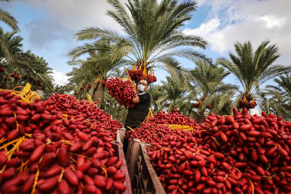
At the end of its reign, the Ottoman Empire called it Deir al-Balah instead of Deir al-Darum, in reference to the establishment of the first monastery in Palestine on its lands, which was established by Saint Hilarion, who was buried in the eastern neighborhood of the city, and also because of the abundance of palm trees around it.

the date
Amr bin Al-Aas conquered it in the year 13 AH after the Battle of Dathen, then the Crusaders overthrew it and it became one of the main cities in the Crusader Kingdom of Jerusalem, and the Crusader King of Jerusalem, Ammuri, established a castle in it with 4 towers to defend it.
It was difficult for Saladin to liberate it in 1170, but he returned and liberated it in 1177 AD. It is considered the first city liberated from the hands of the Crusaders in Palestine.
During the time of the Mamluks, it was a postal station between Egypt and Gaza after 1192, then it entered the rule of the Ottoman Caliphate in 1517 AD.
Darom came under Egyptian rule in 1831, then fell under British rule in 1918. In 1948, many Palestinians fled to it and settled on its coast, establishing Deir al-Balah camp there.
In 1967, it fell under the control of the Israeli occupation, and many Israeli settlements were established there in 1971, including the “Kfar Darom” settlement, and on its borders is the Netzarim settlement.
Deir al-Balah camp
It is located near the Mediterranean coast, west of the city of Deir al-Balah. It is bordered to the north by the Nuseirat camp, 5 kilometers away.
Deir al-Balah camp is one of the smallest refugee camps in the Gaza Strip. Its area when it was established was about 156 dunums, then it was reduced to 132 dunums.
The Palestinians who fled their homes in central and southern Palestine as a result of the Nakba of 1948 sought refuge there.
Its population, according to estimates by the Central Bureau of Statistics in 2023, was about 8,161 refugees.
The camp suffers from problems including: power outages, restrictions on fishing areas, high population density, and contaminated water supplies.

Towns on the borders of Deir al-Balah
- Wadi Salqa town
The lands of Wadi al-Salqa are historically part of the city of Deir al-Balah, but in 1994 the Palestinian Authority adopted a new administrative division for the Gaza Strip, and in 1996 it issued a decision to establish an agricultural village on the lands of Wadi al-Salqa, administratively affiliated with the Central Governorate.
The town is considered the Gaza Strip’s basket of vegetables, as agricultural land constitutes about 85% of its land.
It is 2.4 kilometers southeast of the city of Deir al-Balah. Its land area is estimated at about 6,000 dunums, including 2,000 dunums on the border separating the occupied territories.
In the town there is the grave of the great companion Abu Ubaida bin Al-Jarrah.
- Al-Zawaida town
It is located in the heart of the Central Governorate, bordered by Al-Nuseirat Camp to the north, Al-Bureij Camp to the northeast, and Al-Maghazi to the east.
Administratively, it belongs to the Central Governorate, and is separated by Al-Rashid Street from the Mediterranean coast, and is 2 kilometers northeast of the city of Deir Al-Balah.
Its area is about 7 thousand dunums. It was occupied by Israeli forces in 1967 and liberated in 2005.
historical landmarks
- Deir al-Balah Cemetery
The cemetery includes many coffins made in the shape of a human, dating back to the Bronze Age, exactly 1200 BC.
These coffins were discovered in graves dug from karkar stone or red clay, along with quantities of vessels, some made of alabaster, and others made of Canaanite, Cypriot, and Egyptian pottery.
General Moshe Dayan organized an archaeological excavation campaign in the region and included all the finds he found in his personal possessions. After his death, his heirs sold them to Israel.

On the coast of Deir al-Balah is an archaeological site in which a large Phoenician colony was found, with high defensive walls approximately 600 meters long, in addition to a Phoenician-style cemetery for burying the ashes of bodies after cremation, dating back to the Iron Age (138-332 BC). The excavators also uncovered pots made of Of the pottery called Raqish.
The site’s size and general appearance suggest that it was a seaport on an ancient trade route.
- Al-Khader Mosque and the Crusader Monastery
It is about 200 meters south of the city of Deir al-Balah. It was built over an old monastery that takes on the character of Crusader architecture, and features Greek inscriptions and marble columns.
An archaeological site in which a mosaic floor dating back to the Bronze Age was found, located south of the Nuseirat camp.
It is a shrine built above the monastery of Saint Hilarius, which dates back to the third century AD, and is located in the center of the city of Deir al-Balah. The shrine contains a mihrab, several domes, and a children’s library.