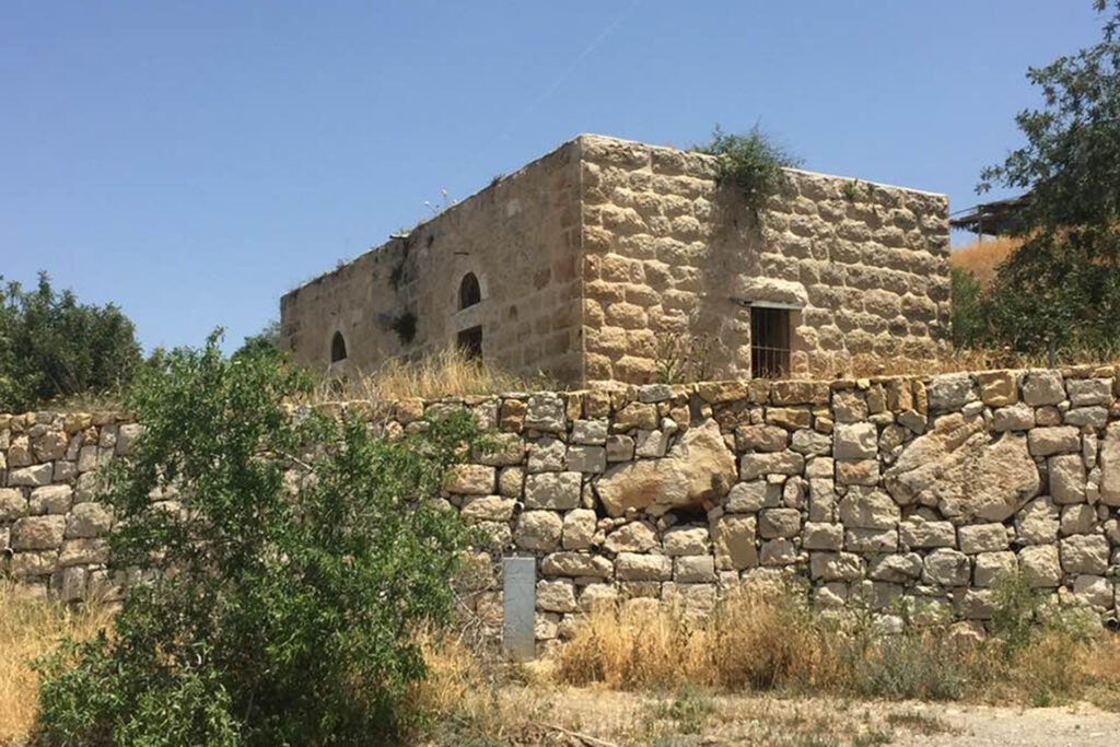
A Palestinian village that has been displaced since 1948. It is one of the villages in the Jerusalem district. It and its people had an active role in the historic battle of Bab al-Wad because of its strategic location. Its people tell some stories that say that they are among the noble Husseinis who belong to the family of the Messenger of God, Muhammad, may God bless him and grant him peace.
During the 1948 war, the Israeli occupation forces attacked the lands of Beit Mahsir, expelled its residents and destroyed their homes, then established the “Beit Meir” colony on its lands in 1950.
the site
The village of Beit Mahsir is located on a relatively high area of the Jerusalem mountains, about 600 meters above sea level, and is 26 kilometers west of the city of Jerusalem.
Its lands are surrounded by the lands of several villages, including: Saris, Soba, Al-Qastal, Beit Jiz, Beit Thuwal, and Ishua. It overlooks what is known as the Bab Al-Wad Valley, and it overlooked secondary roads that connected it to the Jerusalem-Jaffa main road.
Population
Its population was estimated at about 450 people in the late 19th century (1875), and in 1931 its population was estimated at 1,920 people who lived in 445 houses, and this number rose in 1945 to 2,400 people.
Economy
The village’s economy was primarily based on agriculture, and the residents of Beit Mahsir worked in rain-fed agriculture (which relied mainly on rainwater), and grew grains, fruit trees, olives, and vines. Forests covered large areas near the village.
In 1944-1945, a total of 6,225 dunums were allocated to grain, and 1,342 dunums were irrigated or used for orchards. The village has an olive press and wheat mills, and the residents used to obtain water from a spring located in the northeastern part of it.
Village landmarks
Its houses were built of stone and brick, and its plan took the shape of a trapezoid, and the houses are adjacent to each other in clusters representing the four neighborhoods in the village. It is crossed by a main street from east to west, on both sides of which are shops and some other public facilities, such as the village mosque, a primary and secondary school, and a girls’ school.
The people of Beit Mahsir are proud that the village sheikh and imam of its mosque was a graduate of Al-Azhar Al-Sharif. There are two shrines in the village, one of which belongs to Sheikh Ahmed Al-Ajmi and the other belongs to Sheikh Al-Salih Ahmed Taj Al-Arfin, who some narrations say traces his lineage back to the Messenger of God, Muhammad, may God bless him and grant him peace.
The village buildings extended in its urban development in the form of axes along the roads leading to the village of Saris on the Jerusalem-Jaffa road. Urban growth led to the village’s area expanding to approximately 77 dunums.

Occupation of Beit Mahsir and displacement of its residents
Although the village was targeted by the occupation during Operation Nahshon in early April 1948, it was not occupied until the first half of May 1948.
Following Operation Nahshon, the Haganah launched a series of attacks seeking to expand the corridor it had built to Jerusalem, and to seize the strategic center of Latrun, and Beit Mahsir fell during Operation Maccabi at the hands of the Harel Brigade.
In late March 1948, the New York Times reported that the British army briefly occupied the village. Beit Mahsir resisted a British attack after the Arabs raided the western colony of Hartouf.
Beit Mahsir village after displacement
Several houses remain in the village, which today appear scattered, with the remains of cave entrances and wells, and two abandoned houses.
The remains of a wheat mill, a metal machine with balance wheels mounted on a stone structure, are still visible. Extending from the eastern end of the village is an ancient wild forest with trees covering the top of the mountain.
Several graves are scattered among the trees, including the grave of Al-Ajami. There are also still ruins of stone houses on the western side of the site, as well as ruins of the stone walls surrounding the orchards.
Settlements in Beit Mahsir
In 1948, the “Beit Meir” settlement was established on the lands of Beit Mahser, and in 1950 the “Masilat Zion” settlement was established to the northwest of the village.

