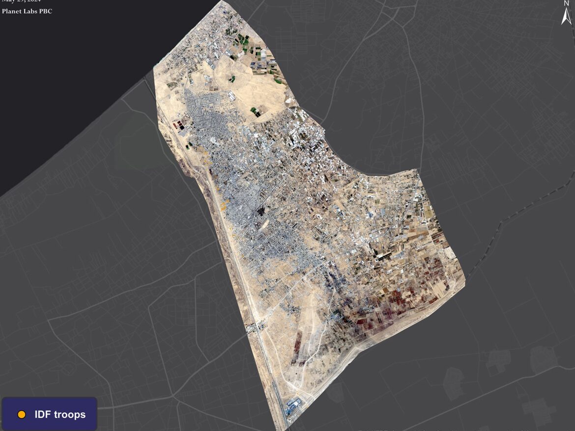
Satellite images taken on May 29 showed the incursion and deployment of the Israeli occupation forces into 22% of the area of the Palestinian city of Rafah, with the stationing of 258 military vehicles in various areas and along the Philadelphia axis near the Egyptian border from the west of the Rafah crossing to the Tal al-Sultan area.
The Israeli army began a ground attack on the city of Rafah on May 7, when tanks and military vehicles invaded the Rafah land crossing and closed it. Military operations continued until the 29 of the same month when Israel announced its control of the Philadelphia axis, the strategic border strip between the Gaza Strip and Egypt.
Satellite images
Satellite images showed the distribution of Israeli military vehicles inside the city of Rafah, where about 15 military vehicles were stationed in the vicinity of the Kerem Shalom crossing, and about 15 other vehicles were stationed inside the Rafah crossing from the Palestinian side.
29 military vehicles were also distributed in the northern neighborhoods of Rafah, including Shokat Al-Safi, Al-Salam neighborhood, and Al-Geneina neighborhood.

199 military vehicles were deployed along the Philadelphia axis near the Egyptian border, from the west of the Rafah crossing to Tal al-Sultan.
The images also showed high rates of destruction in the city’s neighborhoods, such as the Tabba Zare neighborhood, the Tal al-Sultan neighborhood, and the Shoka al-Safi neighborhood.

A comparison between photos of neighborhoods on May 15 and 29 reveals the extent of the massive destruction carried out by the occupation army in these areas.
Destruction rates in agricultural areas and residential buildings on the outskirts of these neighborhoods increased significantly.


